Popular hikes
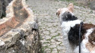
Embark on a charming and easy journey to meet Alfred, Polina's friendly farm donkey, you might also meet on the way Simona the mule of our neighbors.
Difficulty: Easy, 2,5 km loop
Duration: 35-45 min
Fornalutx - Mirador Ses Barques
For breathtaking scenery Ses Barques, follow this road: Start by taking Camí de Bálix and continue along the Ma-10 highway. Along the way, you’ll find a trail that leads you to Ses Barques. At Ses Barques, savor an amazing lunch at the restaurant on-site, offering an incredible view of the valley.
Difficulty:Medium
Duration: 2.30h
Distance: 2.95 km
Fornalutx - Biniaraix - Sóller (see photos)
Circular walk leaving the village past the town hall building via Cami des Creuer. Follow signs to village of Biniaraix where you can stop for refreshments and the best cakes and scones at bar bodega in the village square before leaving via the public washhouse area taking the road to the right, back towards Fornalutx (short circle). Or continue toward Cooperativa Agricola de Sóller, where you can find products from local farms. We recommend lunch at Tres Llunes in Sóller (reservation needed). From there, go towards Camí de Binibassi and the walking path will lead you straight to the hotel.
Difficulty: Medium
Distance: 7km
Duration: 2-3 hours
Fornalutx - Binibassi - Sóller
Start your walk directly from the hotel, following Camí de Binibassi. Shortly after beginning your journey, you'll pass the Fornalutx Cemetery on your left. Continue along this peaceful path, surrounded by olive groves and traditional dry-stone walls, until you arrive at Binibassi, a small and picturesque hamlet. From Binibassi, follow the signs toward Sóller, taking the scenic Camí de s'Ermita. This path gradually descends through terraced fields with stunning views of the Sóller Valley. The route connects with Avinguda d'Astúries, leading you straight into the heart of Sóller. Once in Sóller, you can relax in the Plaça Constitució, explore local cafés, or take the historic tram to Port de Sóller.
Difficulty:Medium
Duration: 2 hours
Distance: 4 km
Fornalutx - Barranc - Coll de l'Ofre - Cuber reservoir
Explore the stunning Barranc de Biniaraix, a deep gorge leading into the Soller Valley. Begin in Fornalutx and follow the Ma-2121 road through Biniaraix, continuing through Camí Font de Cas Patró Lau and the GR221 trail. The final forest path to Coll de l’Ofre takes about 30 minutes and offers fantastic views of the mountains, Soller valley, and Mediterranean sea. Descend (optionally) towards Cuber reservoir through a Province-like landscape with grayish-green hues, dotted with rosemary, sage, and lion flowers.
Difficulty: Moderately difficult
Duration: 4-5h
Distance: 12,9 km
Cuber to L'Ofre
Puig de L’Ofre (1093 meters) is a mountain in the central Tramuntana mountains on Mallorca Island, Spain.
The summit is easy to reach from the Cúber Reservoir, located along the Ma-10 road, 20 km northeast of Sóller.
Starting at the car parks at Cúber, the trail follows the western shore of the reservoir and continues up the valley to the Coll de l’Ofre saddle. From here, most hikers continue on a wide track to Coll de Poma, where the ascent starts. Until this point, the hike requires little exertion.
To reach the summit, hikers must conquer a final 190 meters up the steep forested southern slope of Puig de l’Ofre.
Distance: 11.5 km out-and-back
Duration: 3:30 – 4 hours
Elevation Gain/Loss: 430 meters
Difficulty: Moderate
Puig des Tossals Verds
A very satisfying circuit trail loops around Puig des Tossals Verds, following the GR 221 almost the whole way.
This trail is scenically varied. The trail meanders between beautiful limestone mountains, above narrow gorges, through olive groves and oak forests, and along a long water canal.
Starting near the Cúber Reservoir, the trail first ascends to Coll de sa Coma des Ases. From the saddle, the trail descends across a stunning high valley towards the Torrent d’Almedra stream/gorge.
It continues to the managed Refugio Tossal Verds and up through an olive grove and oak forest to Coll des Coloms. The final leg follows the Canal des Embassaments water canal all the way back to the Cúber bus stop/car park.
Distance: 11.4 km circuit
Duration: 4:30 hours
Difficulty: Moderate
Easy Walks in Mallorca
- Camí de Cala Boquer
- Cúber Reservoir Circuit Trail
Moderate Hikes in Mallorca
- Deià – Cala Deià – Cala Llucalcari
- Castell d’Alaró
- Cúber to Puig de l’Ofre
- Mirador d’en Josep Sastre and the La Trapa Ruins
Moderately Difficult Hikes in Mallorca
- Archduke’s Trail
- Tossals Verds Circuit Trail
- Talaia d’Alcúdia and Platja des Coll Baix Circuit Trail
- Cornador Gran
https://www.moonhoneytravel.com/best-hikes-in-mallorca/
https://www.alltrails.com/es/spain/mallorca/fornalutx


